EMoSEM
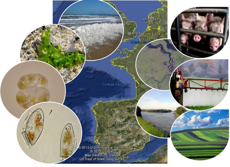
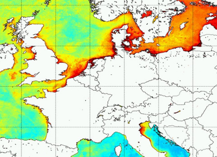
One of the leading challenges in marine science and governance is to improve scientific guidance of management measures to mitigate eutrophication nuisances in the EU seas. Existing approaches do not integrate the eutrophication process in space (continuum river-ocean) and in time (past, present and future status). A strong need remains for (i) knowledge/identification of all the processes that control eutrophication and its consequences, (ii) consistent and harmonized reference levels assigned to each eutrophication-related indicator, (iii) identification of the main rivers directly or indirectly responsible for eutrophication nuisances in specific areas, (iv) an integrated transboundary approach and (v) realistic and scientific-based nutrient reduction scenarios. EMoSEM aims to develop and combine the state-of-the-art modelling tools describing the river-ocean continuum in the North-East Atlantic (NEA) continental seas, in order to link the eutrophication nuisances in specific marine regions to anthropogenic inputs, trace back their sources up to the watersheds, then test nutrient reduction options that might be implemented in these watersheds and propose consistent indicators and reference levels to assess Good Environmental Status (GES). To achieve this objective, the research has been organized in 8 connected WPs. WP1 will upgrade existing marine ecological models by including numerical methods allowing to track the river or oceanic origin of nutrients in marine phytoplankton and to evaluate region-specific N and/or P reductions needed to reach eutrophication GES (“distance-to-target”). WP2 will implement and validate a new generic watershed model of the NEA rivers calculating nutrient inputs to the sea under different scenarios of wastewater treatment and agricultural practices. The river and marine ecological models will be combined in WP3 to propose reference ecosystem-based indicators (GES) for the NEA waters, based on a comparison between phytoplankton bloom simulations performed under pristine and present-day conditions. The agreed indicators will be used as GES targets in the next WPs. In WP4, both the nutrient sources at the origin of eutrophication nuisances in specific areas and the nutrient reduction needed to achieve GES will be assessed making use of the tools developed in WP1. Model simulations in WP5 will further explore how realistic nutrient reduction measures applied to agricultural and urban sources of nutrient in the watersheds might allow to reach GES in some NEA coastal waters. EMoSEM achievements will be synthesized in WP6 and discussed in terms of eutrophication assessment and mitigation. Outreach activities (WP7) will target both the scientific community (publications, conferences) and end-users, especially policy-makers involved in the implementation of the WFD and MSFD and OSPAR recommendations. Networking and project management is described in WP8. At the end, EMoSEM will deliver coupled river-coastal sea mathematical models that could be used as guidance by end-users (Policy- and decision makers) for assessing and combating eutrophication problems in the NEA continental waters.